Marine Services Overview
CSR GeoSurveys Ltd. specializes in high resolution marine geophysical surveys. The company has conducted 100's of surveys over the past 35 years for projects such as harbour developments, submarine pipelines, submarine telecommunication, power cables, dredging projects, geohazard assessments, sub-sea structure monitoring, ice scour studies, habitat mapping, unexploded ordnance (UXO), and charting. We have also compiled regional geological, bathymetric, and ice scour studies as well as project specific desk top studies.
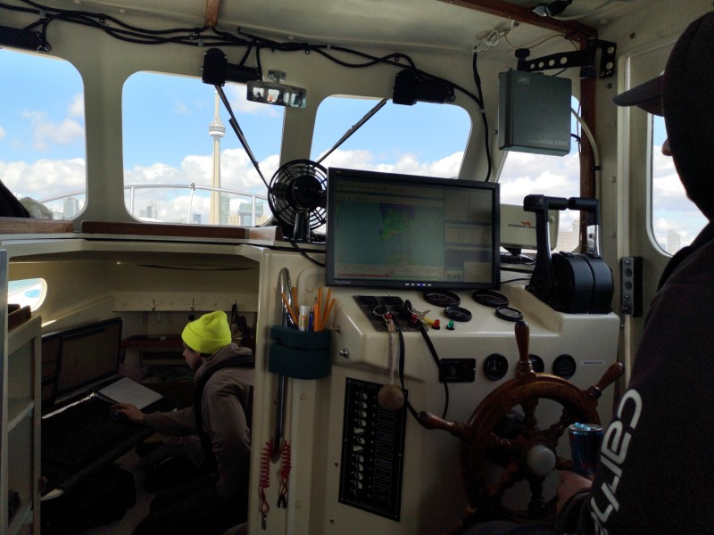
We take great pride in collecting high quality geophysical data that can be relied on for the planning and execution of engineering projects. Field efficiency and data accuracy are very important to CSR GeoSurveys Ltd. The company also excels in producing high quality technical reports and mapping products.
- Multibeam and Single beam Hydrographic Surveys
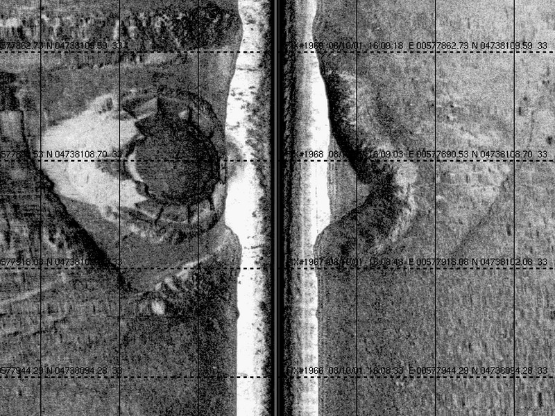
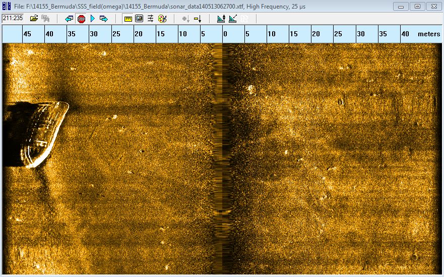
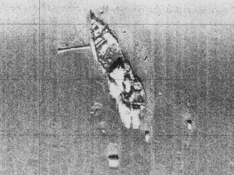
- Sidescan Sonar Surveys
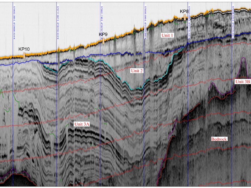
- Sub-bottom Surveys utilizing Single Channel & Multi-Channel Seismic reflection, Chirp Profiler, Sparker, and Airgun
- Seismic Refraction Surveys
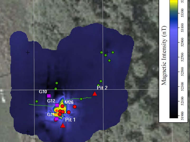
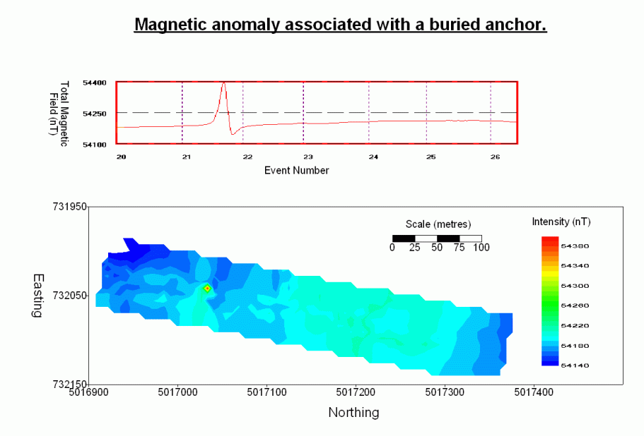
- Magnetometer Surveys
- Underwater Video Data Collection
- Electromagnetic Surveys
- Surface & Sub-surface positioning
- Geologic Sampling (Grab Sampling, Vibracoring, Gravity Coring, Drilling)
- Oceanographic Data Collection (Currents, Water Levels, Wave Heights, Turbidity)
- Remotely Operated Vehicle (ROV) Inspections
- Vessel Charters
Gallery

- Overview
- Marine Geophysical Surveys
- Marine Geotechnical & Environmental Investigations
- Multibeam & Single Beam Hydrographic Surveys
- Ghost Gear Recovery
- Pipeline & Cable Route Surveys
- Shallow Sub-Bottom Investigations
- Ice Scour Surveys and Analysis
- Unexploded Ordnance (UXO) Surveys
- Marine Search and Salvage