 Mining Exploration
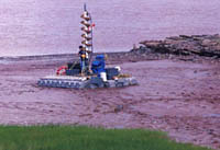
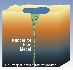
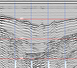
CSR offers a unique series of seismic reflection and refraction profiling tools in order to map bedrock that is covered by unconsolidated sediments. Such seismic profiles are used for diamond and massive sulphide exploration by mapping kimberlites and fault planes respectively.
- Marine Placer Deposits
- Lake Bottom Kimberlite Mapping
- Fault Mapping
- Ocean Mining
- Aggregate Mapping
- Overview
- Marine Geophysical Surveys
- Marine Geotechnical & Environmental Investigations
- Multibeam & Single Beam Hydrographic Surveys
- Ghost Gear Recovery
- Pipeline & Cable Route Surveys
- Shallow Sub-Bottom Investigations
- Ice Scour Surveys and Analysis
- Unexploded Ordnance (UXO) Surveys
- Marine Search and Salvage