Route Assessment Project, Chukchi Sea
Resource development planning in the Chukchi Sea has led to the assessment of survey routes to obtain a better understanding of the ice gouge processes, surficial geology, and shallow sub-bottom geology.
CSR GeoSurveys Ltd. was contracted to compile route assessment panel maps using pre-existing geophysical survey and seabed sample data in the Chukchi Sea. CSR had previously carried out mapping and assessment of ice gouges, sub-surface horizons, and surficial sediments within the Chukchi Sea, which have been utilized for this project.
Gallery
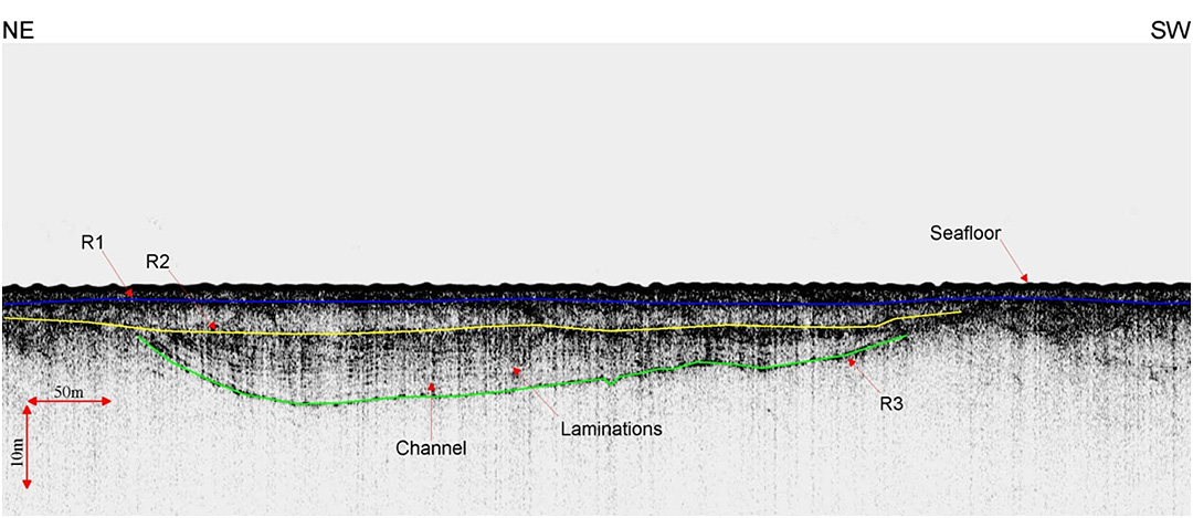
A comprehensive report and maps were compiled as a result of this project.
- Port Development, Montserrat
- Chukchi Shelf Regional Studies
- Submarine Cable Reinforcement Project
- Offshore Wind Turbine Project
- HVDC Submarine Power Cable Project
- Submarine Pipeline Project
- Sea of Okhotsk (Russian Arctic)
- Route Assessment Project, Chukchi Sea
- Resolute Bay (Canadian Arctic)
- Hydrographic Surveys, Halifax Harbour
- Wind Farm Submarine Cable Route
- Artificial Island Sediment Mobility Projects, Beaufort Sea